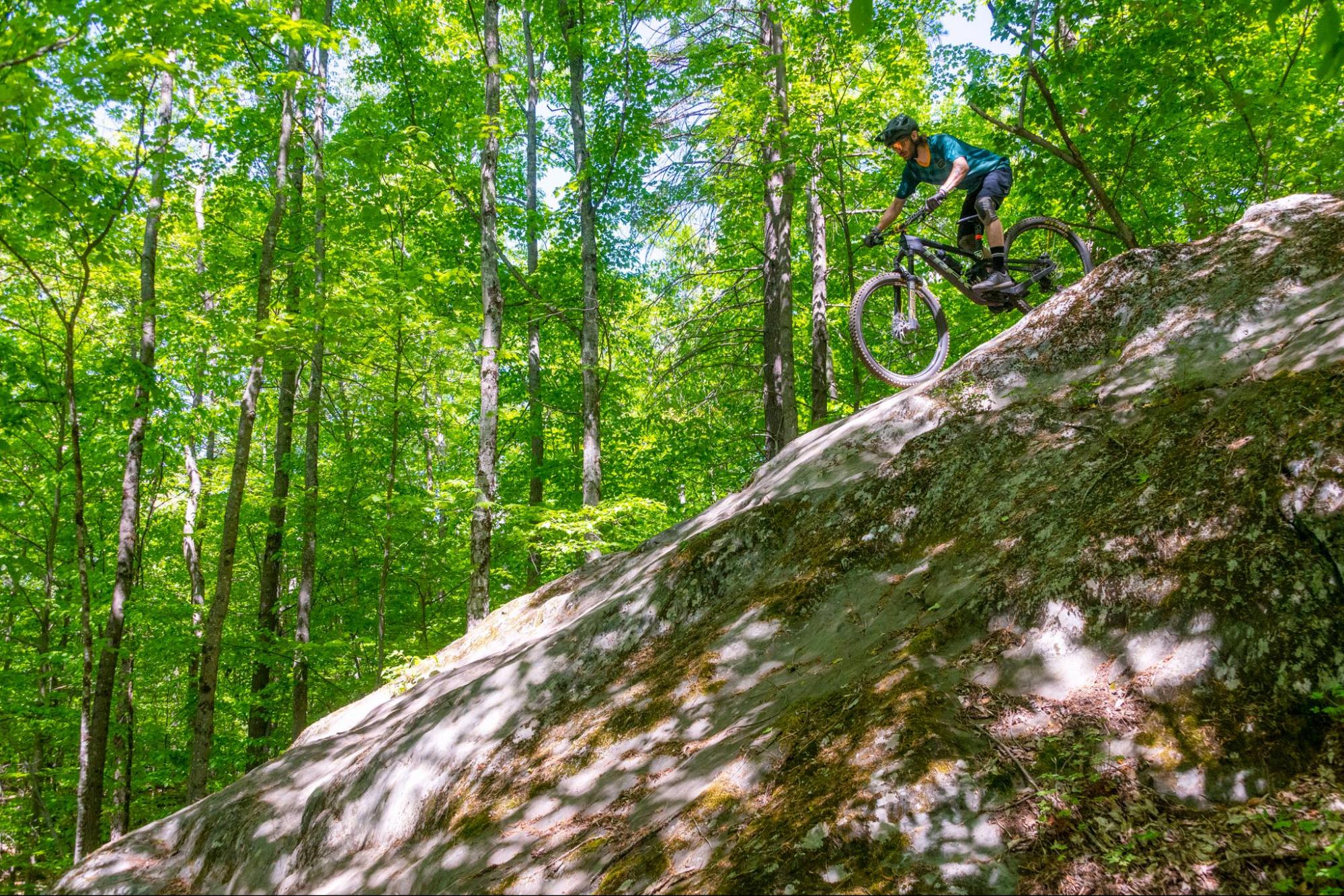
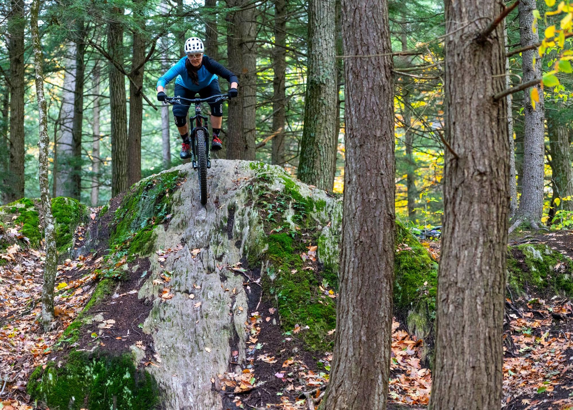
Tim Keenan on Six Flags at Perry Hill
Taking the VMBA Challenge, Part III
Welcome to part three documenting my quest to ride every VMBA chapter this summer. Just to catch you up: Darren Ohl, owner of the Vermont Bicycle Shop in Barre, came up with this idea to prompt riders to explore more of our state’s mountain bike offerings. The first nineteen chapters have been documented in two blog posts on the VMBA Website. Here are the final nine chapters in my challenge.
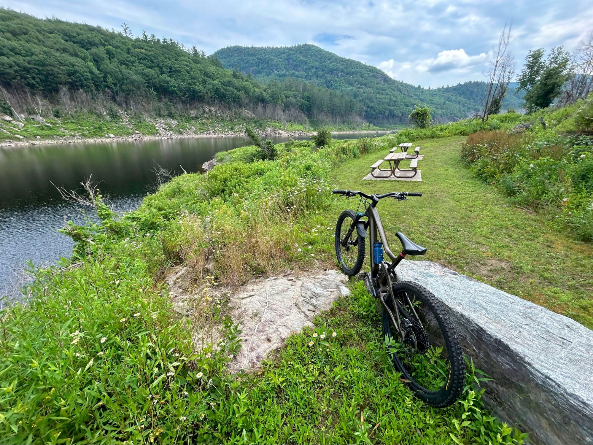
Ball Mountain Lake at the bottom of Hard Corps
Chapter 20: JAMBA
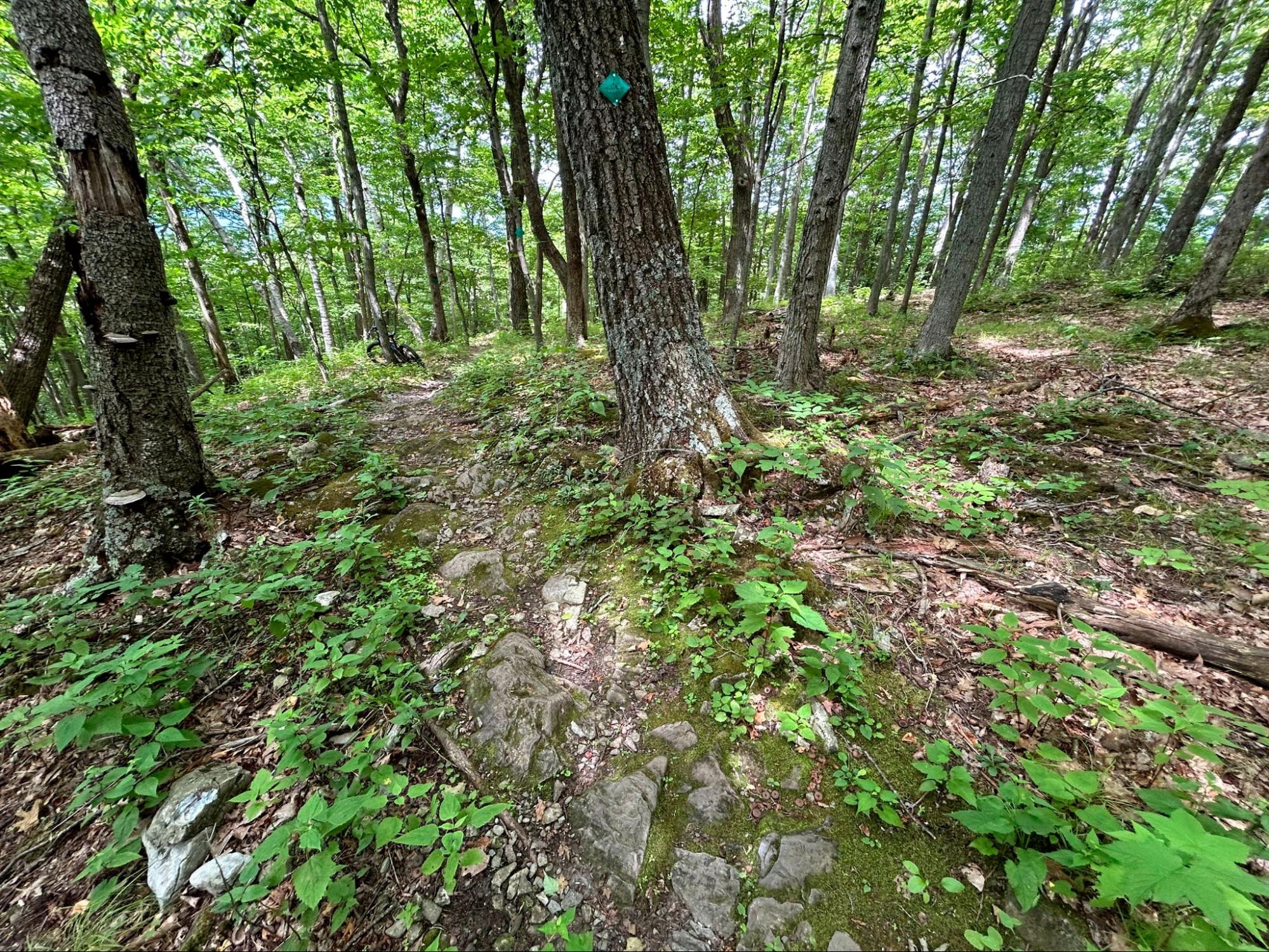
The Jamaica Area Mountain Bike Association is an up and coming chapter with some fun single track based around Ball Mountain Lake. I did a quick lap on the purpose-built trails above the reservoir. Access is off Ball Mountain Lane which connects Route 30 to the Ball Mountain dam. Look for a sign for the canoe portage route on the left and continue down the hill to a small lot at the bottom of the hill on the right. Pedal back up the paved road to the canoe access road and the entrance to Having a Ball is just down the access on the left. There are two trails but they are back to back so there is just one route down. It’s a quick run but makes the most of the terrain with some interesting moves around boulders and rock outcrops. There’s a beautiful lakeside picnic area at the bottom. You either can climb back up the way you came or pedal up the paved canoe access road to get back to your car. If you’re camping at nearby Jamaica State Park or Townshend State Park, bring your bike and knock out some laps.
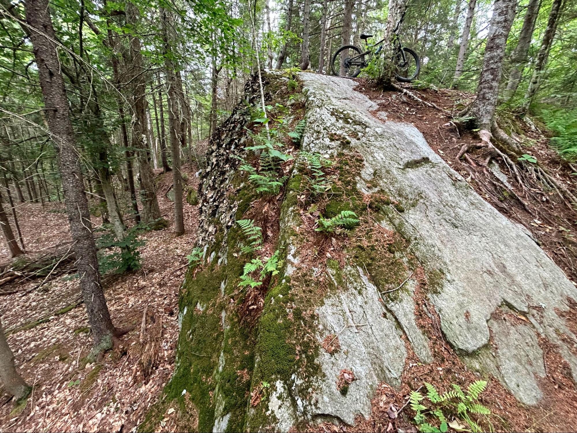
Slab on Cliff Trail
Chapter 21: Southern Vermont Trails Association
A short drive south of Jamaica on Route 100 brings you to the Stratton Town Forest trails. The network is in the southeast corner of the town of Stratton, and much closer to Mount Snow than Stratton, which is a tad confusing. The parking area is on the west side of Route 100 a little below the height of land. I headed south on Fish in a Barrel and quickly connected to Sweet Tooth which is a gentle and well-made climbing trail. I followed the snowmobile trail called Hollywood Shuffle then descended on Silver Fox which is a fast flow trail with berms and small jumps. I turned left on Sweet tooth Down and connected to Blue Brook Boogie which brought me over to the optional Cliff Trail which has a short mica schist slab that is super fun. This compact network is lots of fun and would be a good destination for families or those looking for a quick workout.
Hiking/biking trail on Hogback Mountain
Chapter 22: Hoot, Toot & Whistle
This chapter is problematic for me. There is virtually no public information on trails in their network, no maps, no directions. Through some sleuthing I was able to come up with the name of an active local and messaged him. I didn’t hear back from him in time but heard there were some trails on Hogback Mountain so I wandered around up there for a while. Definitely more of a hiking area than a bike network. There is a multi-use recreation path in Wilmington called the Hoot, Toot and Whistle Trail, but that doesn’t really qualify as mountain biking in my book. The local did get back to me later and sent me a hand-drawn map of a fairly extensive looking trail network on private lands in the area. He said they are happy to provide tours. Now, I understand if private landowners want to limit use of their properties, that’s their right. But I don’t believe this is in keeping with the spirit or intent of VMBA, which is very much about public access. Darren Ohl, from the Vermont Bicycle Shop, who organized the VMBA Challenge, heard similar feedback from other participants about this and a couple other chapters. He says: “I heard from a few riders who encountered that sort of gatekeeping. A couple of messages came from women who were told they’d need to meet up with a male trail board member to find certain trails. While that kind of invitation might seem friendly, it’s not the kind of situation that feels safe or welcoming.” If Hoot, Toot & Whistle wants to keep their trails private or limited to a close circle of friends, that’s fine, but I think they should not be a VMBA chapter.
Chunky terrain on Snail Trail
Chapter 23: Bennington Area Trail System
This chapter is in the southwestern corner of the state and offers a fairly extensive network on the side of Mount Anthony. I parked near the field house on the now defunct campus of Southern Vermont College. The mountain rises steeply to the west. I crossed the open pasture then headed north and climbed a combination of Halloween Tree and Lower Beacon to a height of land. With the exception of one headwall (which might be avoidable) this was well built and interesting. The open oak forest and shale soils are very different from what one encounters in my neck of the woods. The network is built on a pretty steep hillside so there are a ton of bench cut sidehills, kudos to the trail builders. I descended on Snail Trail, which was moderately technical and then opened it up on the southern part of Halloween Tree. This is probably the biggest network south of Slate Valley and I just scratched the surface. Definitely a worthy destination.
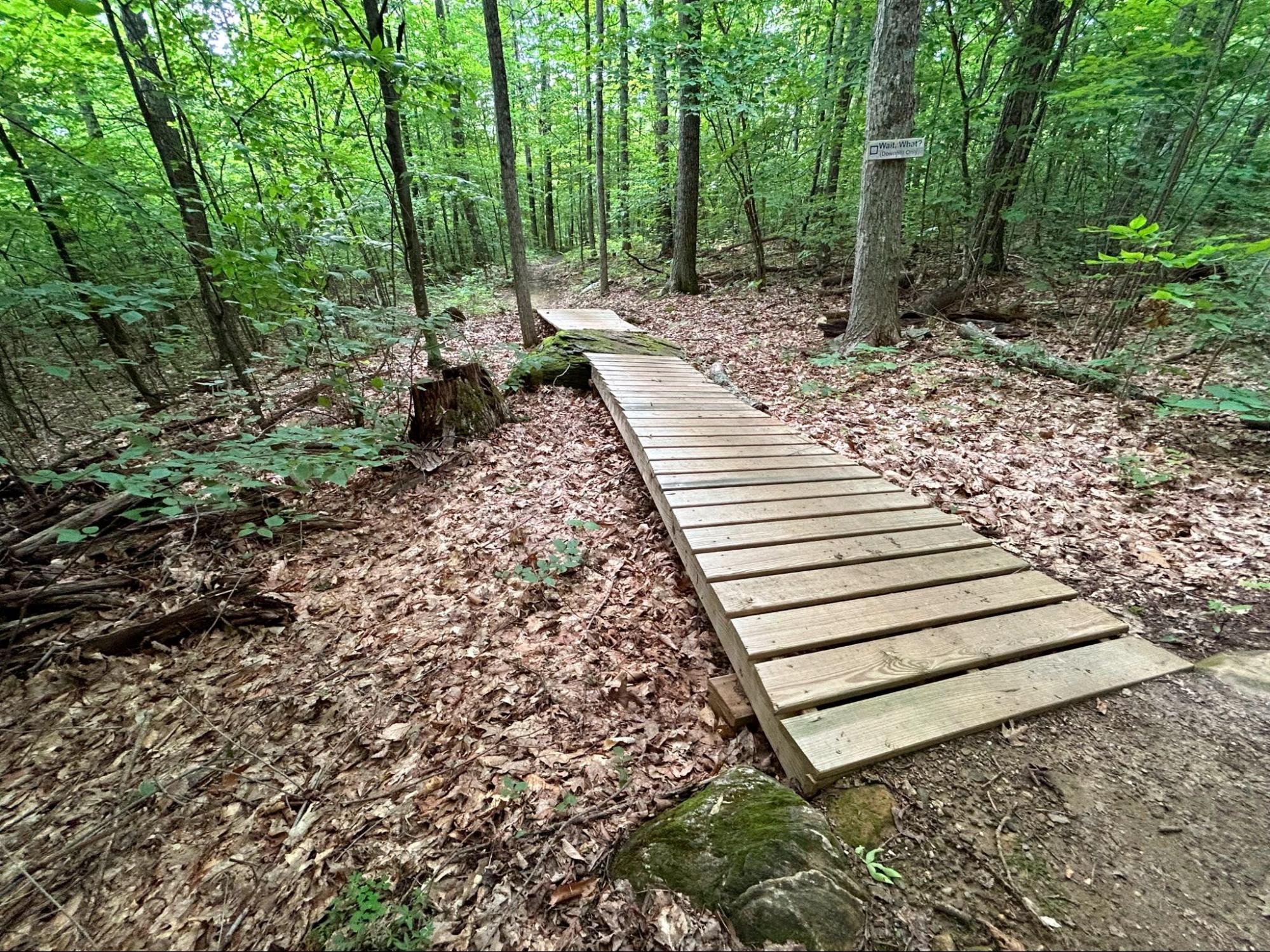
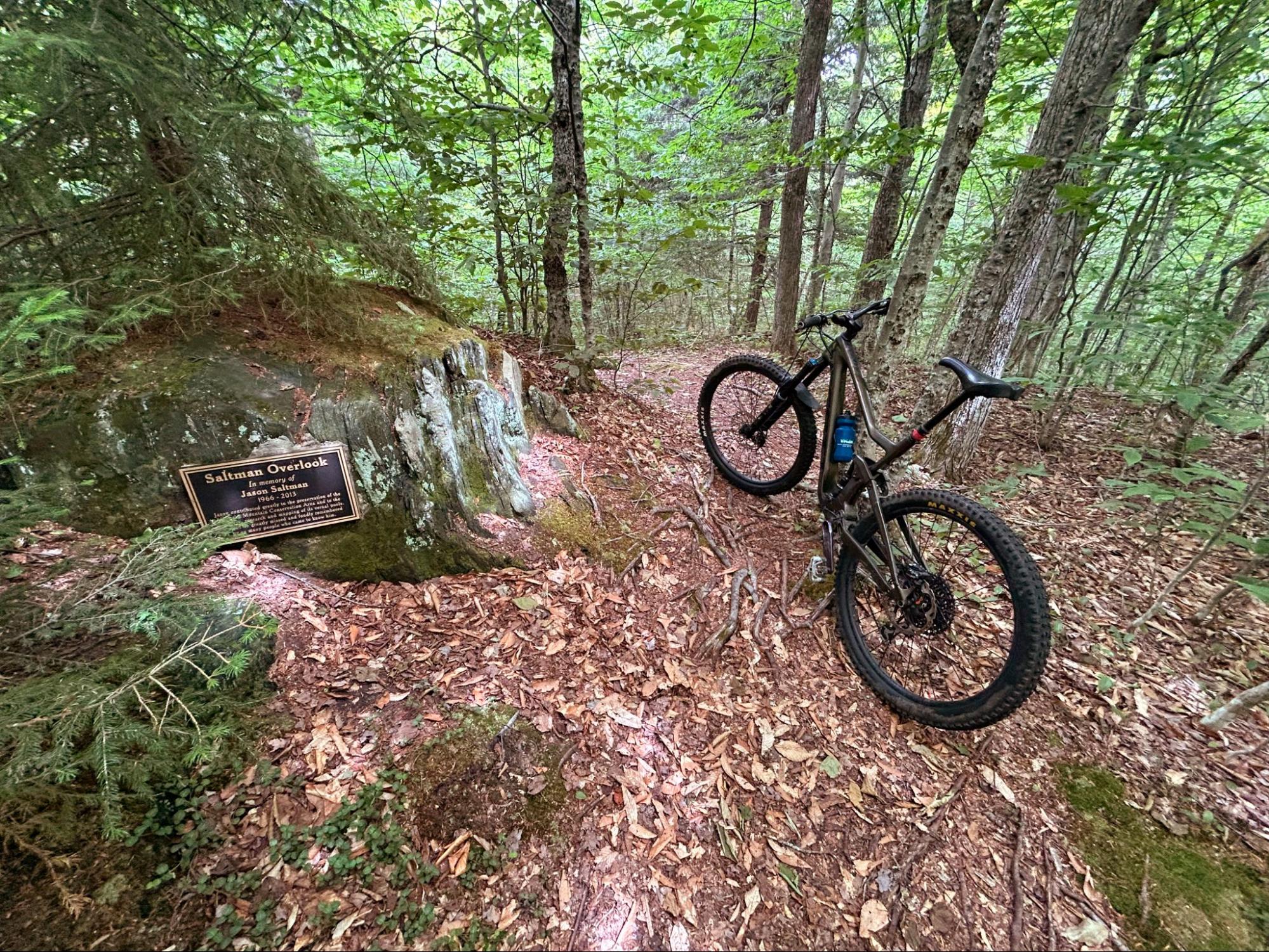
Bridge work on Wait! What?
Chapter 24: Northshire Area Trail System
This chapter is located in the Dorset area with a few different options scattered around the area. Their main trail network is the Raptor Lane Trails located in the Owl’s Head Town Forest just north of town. I parked in their upper lot and headed northwest on Lunch, which is an easy warmup loop. I then followed Sidehill Wampus on a long, beautifully constructed climb to the high point of the network. I could have descended on Gettysberm, but I’ve been trying to ride at least one black diamond trail at each network so I opted for Wait! What? This is a fun romp around the eastern edge of the network with a few features sprinkled throughout. I was expecting a bit more challenge and bigger jumps from this directional trail but it was a good time nevertheless.
Rock work on Butter Up
Chapter 25:Mad River Riders
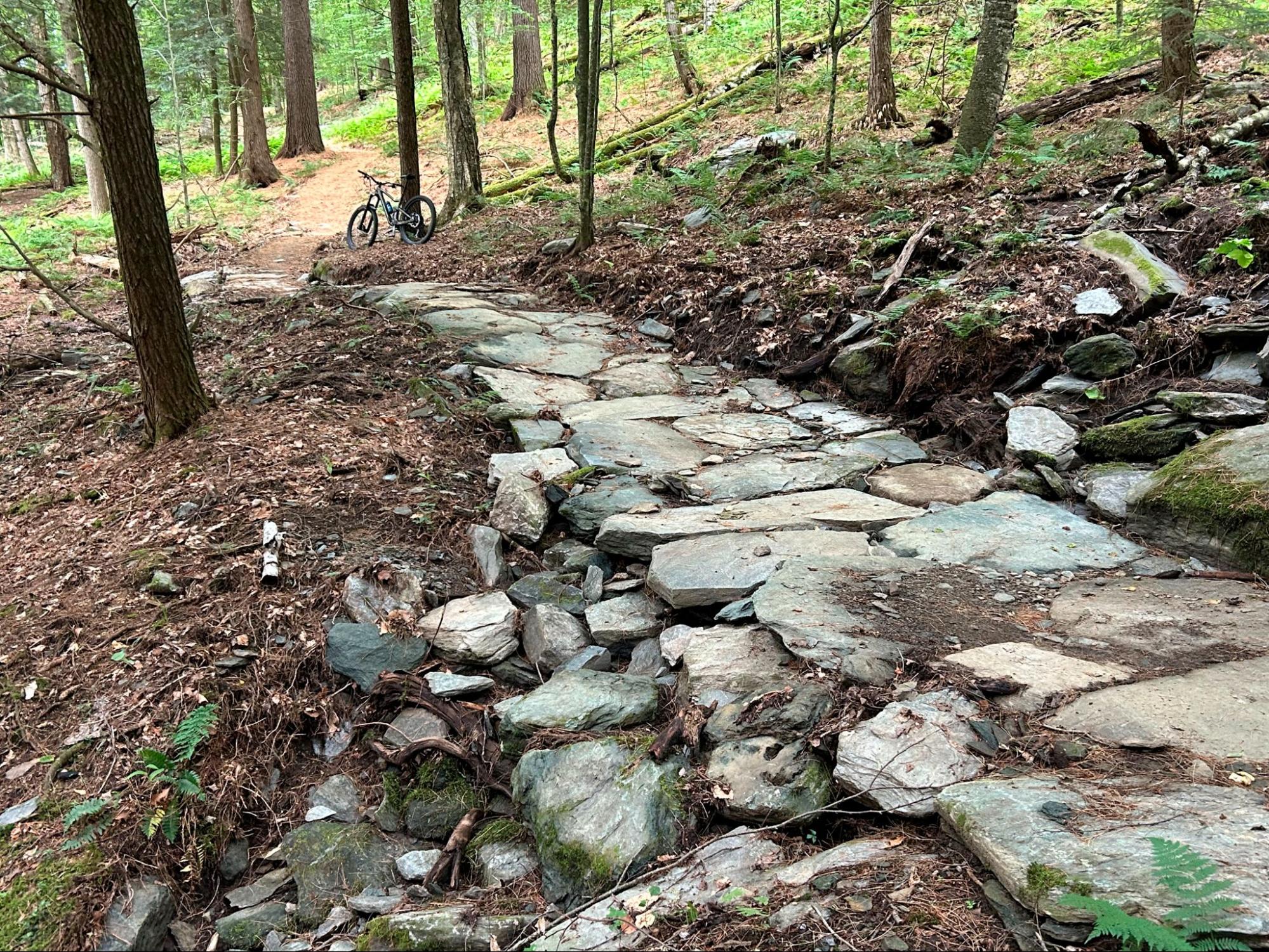
The Mad River Riders network is pretty close to my home and I’ve ridden every trail here numerous times over the years. It’s an under-appreciated network in my opinion. Many of my Burlington-based bike friends have ridden here, opting for the more accessible options on the I-89 corridor. It used to be a pretty rowdy network. The 4th-class climb up Dana Hill deterred many and super technical legacy trails like Cyclone, Clinic and Plum Line kept the crowds away. The addition of Revolution and Evolution added a mellower climbing option a few years ago and really opened things up for a broader audience. My problem with the area is its hard to put together a good loop without including a substantial pedal on roads. That’s still the case, but things are slowly getting better. One small victory in that effort was the addition of Butter Up about a year ago. Good Night Irene is one of the best descents in the Valley but it ended on Butternut Hill Road with nowhere to go but out to Route 100. Butter Up allows you to climb back up Dana Hill after descending Good Night Irene with only a short pedal on a dirt road. The Butter Up/GS/Good Night Irene loop is high on my list of best short rips in Vermont.
Greg Labarthe climbing Tunnel Ridge
Chapter 26: Velomont
The Velomont is an audacious idea for a mountain bike trail that runs the length of the state, akin to the Long Trail for hikers and the Catamount Trail for skiers. The multi-use, hut-supported trail system is a shared project between Vermont Huts & Trails and the Vermont Mountain Bike Association. It will consist of a network of 485 miles of new and existing trail, connecting 23 Vermont mountain biking chapters across public and private lands, and linking 27 communities across the state. When complete, it will represent the largest hut-supported trail network in the U.S. The largest completed portion at this time is known as the Heart of the Greens Loop centered around the towns of Rochester and Pittsfield. The complete loop is a big undertaking and I had limited time so opted for the northern portion starting in Rochester. My friend Greg joined me for the outing and we both marveled at the miles of gorgeously built trail in the middle of nowhere. We rode all the Swan trails (Swan Dive, Swan’s Mill, Trumpeter Swan, Tundra Swan, Mute Swan and Whistling Swan) as we climbed and descended and climbed again to the now famous Tunnel Ridge Trail. I’d done this section before and it is worth returning to. After a steady climb to the 2,582-foot summit of the ridge you are treated to a seemingly endless feast of flowy berms. It feels like it goes on forever.
Sue Clifford on Disneyland
Chapter 27: Waterbury Area Trail Alliance
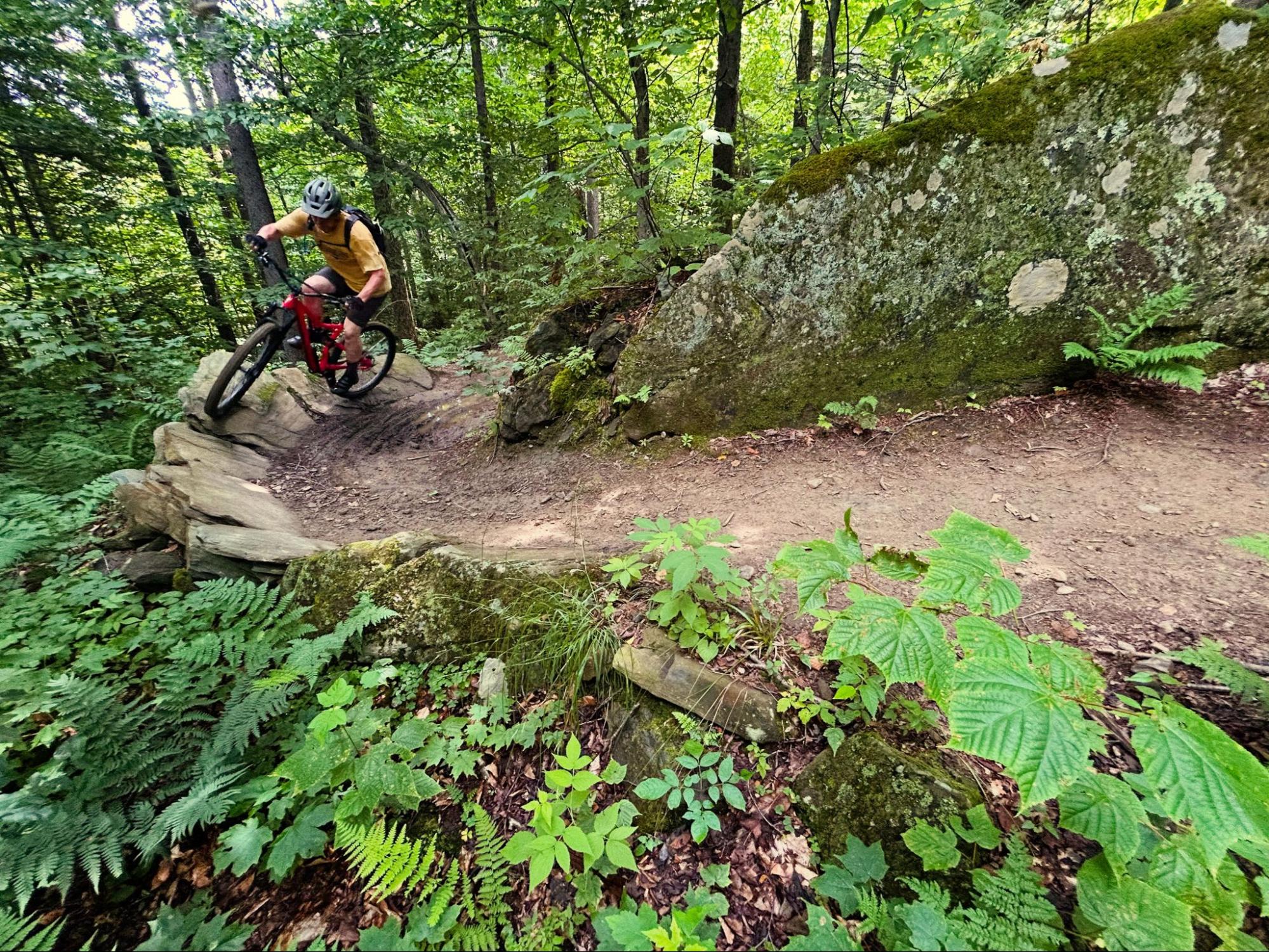
Besides the Butterfield Trails, I probably spend more time at the WATA’s Perry Hill network than anywhere else. I’ve been riding there since the early days and have never gotten tired of the place. That’s partly due to the incredible terrain and partly due to ongoing efforts by the chapter to expand and enhance the riding experience. The main climbing route in particular has undergone substantial improvements over the years. What used to be a red-lining lung-buster right out of the parking lot is now an aerobically comfortable and engaging route up Lower Climb, Red Tape, Scotch Tape and Permission. For this challenge I did a quick lap on Joe’s and Disneyland. Other great options are Six Flags to Disneyland and Burning Spear to Small Axe. The gradings are pretty stiff at Perry Hill and you will encounter all manner of features from hefty rock rolls to narrow bridges to jumps. WATA also offers a smaller network at Waterbury’s Little River State Park, which is well-worth checking out. Look for an entirely new zone developing in the coming years.
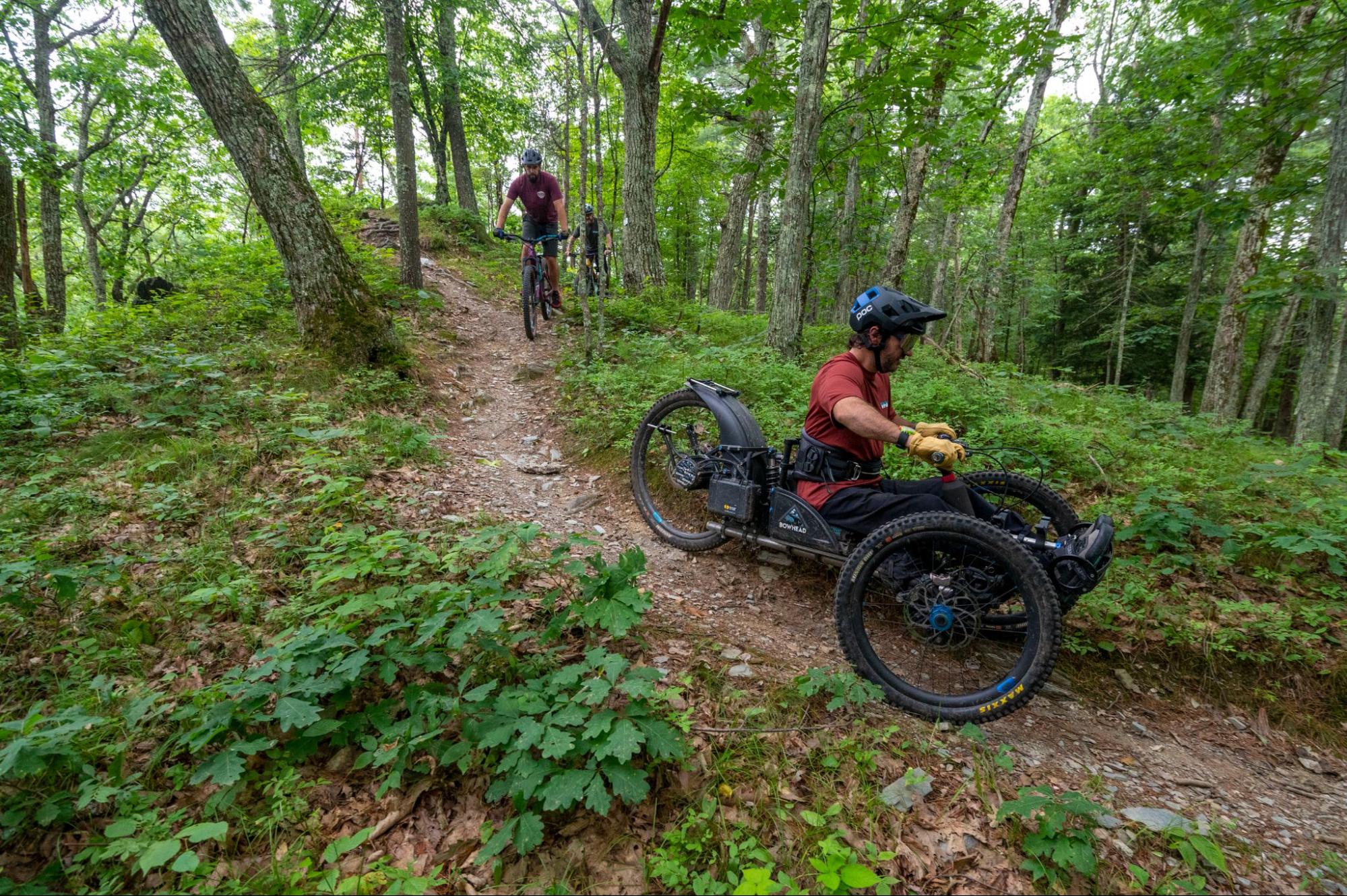
Greg Durso on Rusty Bucket
Chapter 28: Slate Valley Trails
My final chapter was Slate Valley trails in Poultney. I intentionally saved this for last because I’ve been hearing great things about it for years and never got there, and because VMBA was doing an adaptive bike assessment there with my friend and fellow VMBA ambassador Greg Durso, from the Kelly Brush Foundation. Slate Valley is a sprawling network with more than 60 miles of trails and numerous entry points. We met at the Endless Brook trailhead at the far southern end of the network. We did a quick loop on Franz’s Falls and Rusty Bucket before heading north. I split from the group to check out Porcupine, which is one of the finest climbing trails in the state, in my opinion. Long and varied but never overly taxing, this is just a great trail through interesting terrain, including a lovely overlook above Lake Saint Catherine. I descended on Hunker Down which is full of challenging rock features and is crazy fun. I only scratched the surface of this impressive destination network, but the 2026 VMBA Season S’ender party is going to be at Slate Valley so there’s more to look forward to.
So that’s wrap on My VMBA Challenge adventure. It took just under two months to ride all the chapters. According to the Trek Ride Club app I covered a total of 143.3 miles with 48,941 feet of elevation gain. I finished third in the competitive aspect of the challenge. Congrats to Kelsey Laperle who just edged out Trish Dwyer for the win (fun fact: all three of us live in East Montpelier). Big thanks to Darren Ohl at the Vermont Bicycle Shop for dreaming up the idea and providing prizes along with Trek, Bontrager, Endura, and VMBA. The big take away from this experience is that Vermont is absolutely loaded with top-notch riding options. Literally something for everyone in all four corners of our brave little state. Get out there and explore!