TAKING THE VMBA CHALLENGE- PART 1
By Jeb Wallace-Brodeur
I’m a list checker by nature. My father and I climbed all the four-thousand foot mountains in New Hampshire when I was a boy and I loved seeing the list in the back of our old hiking guide fill up with completion dates as we gradually ticked off peaks. Ever since then I’ve been an ardent peak bagger and list checker. When I heard the Vermont Bicycle Shop in Barre was promoting a challenge to ride every VMBA network this summer it took me about two seconds to jump on board. There are numerous networks around the state that I’ve been meaning to get to for years but just haven’t been able to manage it. The VMBA Challenge was the incentive I needed to make it happen. There are 28 VMBA Chapters in Vermont, and I’m not even close to finishing but I’m going to post my progress in batches of ten as I go along. These will be in the order that I ride them and I’ll offer brief summaries of my impressions. I’m only going to ride trails that are mapped and open to the public. Many chapters have zones on private land that are available to ride but the landowners would prefer they not be publicized. Also, I’ve tried to get an idea of what would be the best trails in a network to hit, but often I’m flying blind and trying to put a good route together based on zero actual knowledge of an area. Forgive me if I miss a must-do trail in your home network.
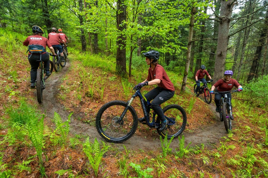
VMBA Ambassadors ride Upper B.S. at Butterfield Trails
Chapter One:
Riders in Plainfield and Marshfield (RIPM) – Butterfield Trails
Big surprise, this was my first ride of the year. I happen to own and maintain this network in North Montpelier. According to the Trek Ride Club app, which I am using to document all my rides, this is a 4.8 mile ride with 1,713 feet of elevation change, not bad for a 70-acre parcel of land. The entire network is hand-built and features narrow, mildly technical single track with numerous jumps and a few bridges. Every feature can either be rolled or has a go-around so there are no mandatory airs. There is a map by the marked parking area at the entrance and another at a trail confluence mid-way through the ride. There are some directional arrows and trail signs but in general just keep going starlight and the network unfolds into one long sinuous route. The only trail that is ridden twice is Double Up, a short connector trail near the end of the ride. The network is on Trailforks, is open to the public and dries quickly after a rain.
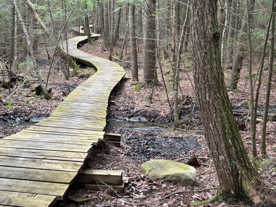
Bridge on Raser’s Edge at Crow Hill
Chapter Two:
Caledonia Trail Collaborative – Crow Hill
This network in Danville is less than an hour from my house and I’d never heard of it before this challenge, my loss because this is a super fun destination. There are two distinct zones on either side of Clark Road, a nice rural area with farms and homes. The east side features a windy climb through mature forest on Rank ’n Roll including a scenic rocky cleft with a cliff band looming over the trail. The climb finishes at a picnic table with views over fields and forests to the west. Continue down on Rank ’n Roll (or a couple new spicier options called Horseradish and Jasper’s that were still under construction when I visited but are now open). Turn west on Dooryard which takes you to Clark Road, turn North and quickly find the entrance to Raser’s Edge on the left. This is a very fun trail that features an epic section of beautifully constructed wood bridging. Take the well-signed entrance to a single track called Buckshot that takes you to another open view to the south. Turn back to the north and enter the woods again on GMC which has a number of rocky features to play on as it winds along the wooded ridge crest. Follow Raser’s Edge and Dooryard back to the parking area. I had some extra time so made the short drive over to the St.Johnsbury Town Forest and rode Broad Wing, a purpose-built mountain bike trail that is adaptive friendly. It’s a beautiful flow loop through open forest and is not very challenging so a good entry point for inexperienced bikers. The loop is about a mile and a half and doesn’t take long to complete so this isn’t a destination in itself but can be added to a trip to Crow Hill or Kingdom Trails or Victory Hill. The Caledonia Trail Collaborative’s building skills are top notch, the trail signage is perfect and their online info is up to date and accurate.
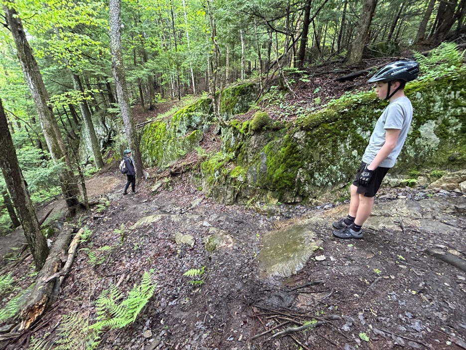
Middle schoolers checking out Lancer’s Leap at Cricket Hill
Chapter Three:
Brewster River Mountain Bike Club – Cricket Hill
Some folks in Chittenden County are familiar with the Brewster River Mountain Bike Club’s main trail network in Pleasant Valley between Underhill and Cambridge. I don’t use Strava, and I imagine there are heat maps out there, but you won’t find any maps of the club’s Valley Trails on their Web site or Trailforks so these fantastic trails are not well known unless you know someone in the club or get some beta. I’ve ridden them in the past and for this challenge I’m trying to get to spots I haven’t ridden yet, which brought me to the Cricket Hill network in Hyde Park. This is a small but really fun network in the hills behind Lamoille Union School. There are two distinct zones on either side of the public parking area on Cricket Hill Road. To the north is the climb and descent route called Bermie Sanders. The climb is very mellow through gorgeous open woods. I met three local middle schoolers on top of the climb who took me on a walking tour of the rock features on the area’s test piece: Lancer’s Leap. Everything was a bit damp so I did a quick summit loop on The Lucky Toad then followed the kids down Bermie Sanders, which has lots of fun little rocky sections in addition to the eponymous berms. I left the kids and climbed back up to give Lancer’s Leap a go. This is a great skill building trail with some small rock rollers and technical features, kind of a miniature Perry Hill. Across the street from the parking area is Megan’s Loop which is an absolute blast with lots of fast long-radius corners and punchy little climbs. It took less than an hour to ride everything so this isn’t a travel destination but if you’re not far away it’s definitely worth a spin.
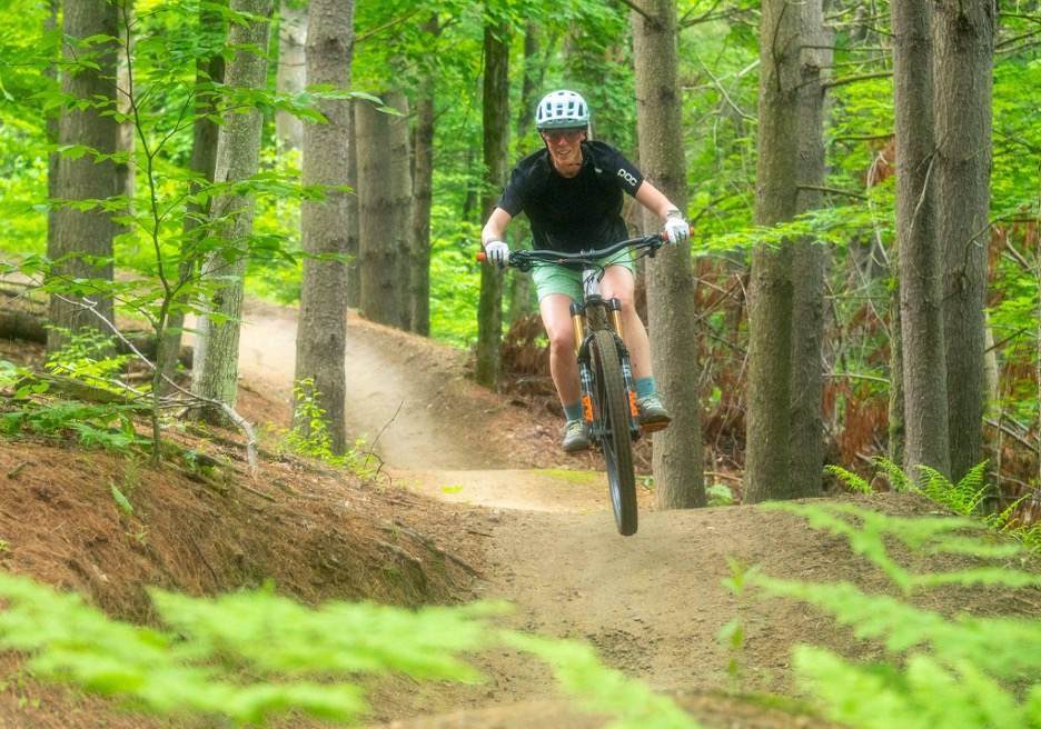
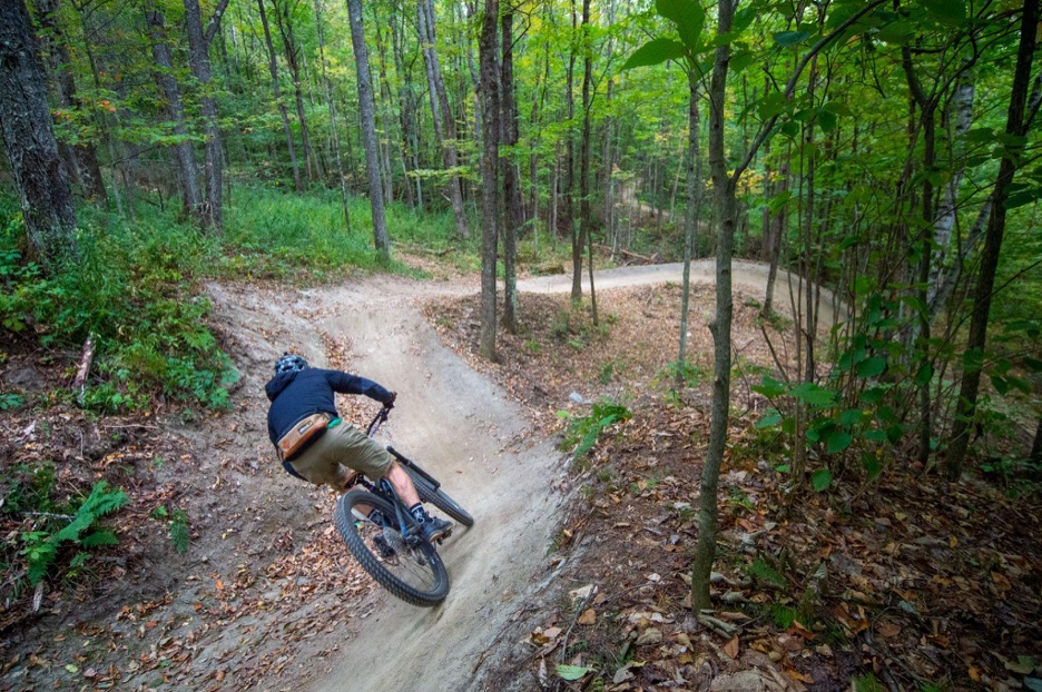
Ripping down Florence at Cady Hill
Chapter Four:
Stowe Trails Partnership – Cady Hill
On my way home from Cricket Hill I stopped in Stowe to log a few more miles. The outstanding trails in the Stowe area are no secret. From Cady Hill to Trapp Family Lodge to Adam’s Camp to Sterling Valley, the Stowe area is loaded with worthy bike objectives. I parked in the Mountain Road lot, which was nearly full on an early-season weekend. The Cady Hill Climb out of the lot is a thing of beauty, really well crafted. Florence, one of the top flow trails in Vermont, had just gotten a refresh and recent rains had made the dirt nice and tacky so the rip down was as good as it gets. Also memorable was my spill on Eagle Ridge Loop later in the ride. The moist spring had turned the wooden berms into banana peels. As soon as I turned the slightest bit both tires cut out and I launched into the swamp, a soft and squishy landing. That cut my ride a little short, and I was nervous about a repeat on Bridgey but managed to stay upright. The high-speed descent back to the parking lot on Bear’s is one of the best finishes to a ride anywhere in the state.
View from Chipman Hill
Chapter Five:
Addison County Bike Club – Middlebury Trails:
This was a new network for me. Even though I attended Middlebury College, most of these trails didn’t exist for biking when I was there. I parked on Springside Road (there are many access points) and started out on Chipman Hill which rises right above the town. The club’s Website recommends climbing Super 7 to the top, which I did, then descended Rehab (which may have been renamed Old Pine?) and climbed again and descended Carls to Tweedle Dee. Of these four trails, only Super 7 is on the Trailforks map or the list of trails on their Web site map, so I was a little confused the whole time. There are lots of walking trails and side trails on Chipman Hill and I found myself checking my location more than usual. Many of the trails feel like hiking trails that have been opened to biking, but Old Pine is a fun descent that felt purpose-built for bikers. After another climb to the top I dropped down the east side on Sidewinder. Except for one section that went straight down the fall line and was just hard braking the whole way, this is a fun and fast trail, just watch for hikers. After leaving Chipman Hill I used the Trail Around Middlebury (TAM) to connect to another zone called Means Woods. This area features a long narrow ridge with a technical loop on it called Megawatt. Though not a huge physical test, it is one of the more challenging tech trails I have ridden in a while, especially in damp conditions. There are loads of rocky shelves and tight corners to negotiate. I then used the TAM to connect over to a third zone: Battell Woods. There were loads of trails in this area with some short climbs and challenging rocky features. The TAM runs right through it so even if you feel lost, you eventually come across the TAM and can find your way out to the north or south.
Kevin Jacques riding Ledges at Millstone Hill
Chapter Six:
Millstone Trails Association
This unique riding area lies amongst active and abandoned granite quarries in Barre Town. I was a member of the trail crew here for years so am very familiar with the riding options. Unfortunately, much of the network lies on private land and some of the all-time classics, like Rollercoaster, Vortex, Fellowship Ring and Scream ’n Demon are no longer accessible due to logging or quarry work. Trails in the town forest are still open though and are a must for anyone looking for an unusual outing. Old quarries filled with water and immense grout piles dot the landscape and in the summer cool air flows from under the rock piles like a giant air conditioning unit. Not surprisingly, this is one of the rockier networks in the state. You won’t find a ton of relaxing flow trails but you will find plenty of challenge and thought provoking moves. For first timers to the area I like to take VAST to #6 Trail with a quick walk up Lawson’s Lookout for a great view of the area. Then VAST to Black Lagoon to Westside then head back on Locomotion to Boulder Dash. If you want more head up lower TNT and turn down Rambler which has some of the funnest riding in the network, including an optional elevated skinny. Though many of the old test pieces are gone, TNT, Capital Loop and Ledges have some of the most technical riding moves in the state and its fun to session the obstacles to find a solution.
Flow riding on Tanager at the North Branch Trails
Chapter Seven:
Montpelier Area Mountain Bike Association (MAMBA) – North Branch Trails
The riding options for Montpelier-area riders took a giant leap forward with the development of the North Branch Trails a few years ago. Well-known builder Brooke Scatchard and his Sinuosity Trails crew created a beautiful, fun riding destination just minutes from downtown Montpelier. It’s easy to hit every trail in the network in a couple hours or less. Most of the trails have bird names, and honestly, despite riding them countless times, I can never remember which bird trail is which. To ride the whole network you will climb up Roll Call Climb three times, which is a bit repetitive but its very well built and pretty short. Quick shout out to the Red Loop at MAMBA’s Irish Hill network in Berlin, which I didn’t do for the challenge but have ridden many times over the years. I’ve heard it said that you only ride here once and that its all climbing in every direction (there are plenty of spots that require braking while uphill cornering, ha!) but I’m one who actually really enjoys these trails. Gorgeous forest and a good workout.
Climbing up Zeebee’s in Randolph
Chapter Eight:
Ridgeline Collective – Randolph Trails
The Ridgeline Collective is a sprawling complex of summer and winter trails in several central Vermont towns. With extensive trail networks in Randolph, Rochester, Pittsfield and Bethel as well as the Velomont Trail, this is a kick butt chapter. They also have some of the best maps and information on their Website, a real bonus for trip planning. I had ridden most of their offerings over the years but had never sampled the Sayward Town Forest trails. Unfortunately, when I got there they were still closed following extensive logging last year (now mostly reopened). Fortunately for me, I decided to try Zeebee’s. This trail starts across from the Randolph hospital and is fantastic. After a bit of double track it turns into a beautifully built climb that is just a joy to ride. Engaging and not too taxing this hit all the right notes for me. Following the climb the trail winds along a remote-feeling ridge with lots of fun ups and downs. Unfortunately I took a branch straight to my right eye resulting in a traumatic cornea abrasion during this section. Riding with only one functioning eye isn’t recommended but I was able to limp along with no depth perception and fluids streaming down my cheek for a few more miles. Zeebee’s eventually runs into Sap Rise which follows a bermy machine-built flow line down to Thayer Brook. There’s no bridge to cross the brook and the stream bed has become pretty wide after consecutive years of flood waters. Rob from The Gear House tells me that trail workers have eased the eroded climb down the bank and plan to create a rock hop crossing. The crossing definitely adds to the wilderness vibe of this route. My eye forced me to bail back to town on Thayer Brook Road at this point but had I been able to see I would have turned left and headed up to climb Hale Trail. Rob said there’s a nice view overlooking the town and the descent down Willing & Abel is a rowdy, techy plunge. I’ll be back to finish this route for sure.
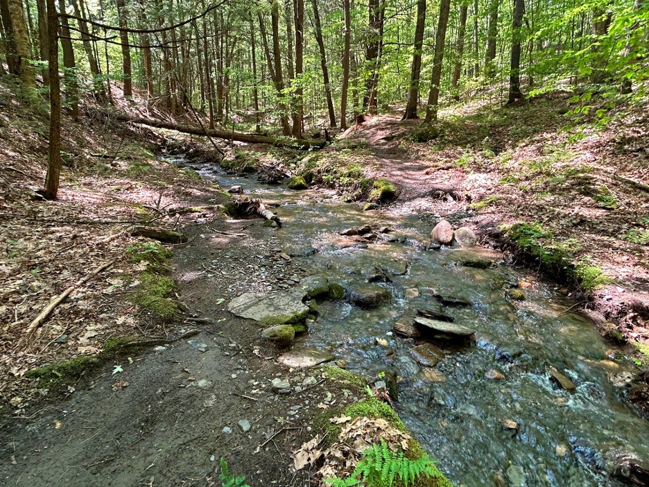
Stream crossing at the bottom of Lower Pine Drop in Hartford
Chapter Nine:
Upper Valley Mountain Bike Club – Hurricane Hill
This chapter is well-known for their Boston Lot network in Lebanon, N.H. These technical, punchy trails are a worthy destination for sure. Having ridden there several times I wanted to try something new so I headed to the Hurricane Hill network across the river in Hartford. I met two lovely women, Julie and Lisa, at the trailhead who gave me suggestions for what trails to ride while there. I set off confidently and immediately went into full wander mode. The trails are well-documented on Trailforks but the signage on the trails uses faded maps with numbers for trails instead of names so it can be a bit confusing at first go. There are also a lot of intersections so instead of stopping every couple minutes to check the map I just forged ahead. That said, there is some fun riding here and definitely less challenging than Boston Lot. Jason’s Trail has some interesting moves and Spine Trail to Pine Drop, if you can find it, is really fun with a cool romp along a stream at the bottom.
Check back later as I document the next third of the challenge, and there’s plenty of time to get on board if you’re interested in joining the fun.